As of January 1, 2024, the Rensselaer Land Trust has merged with the Rensselaer Plateau Alliance. For all questions regarding donations, events, land, or other matters, please visit www.rensselaerplateau.org or call 518-712-9211. For questions about the merger, use extension 101 to speak with Jim Bonesteel. You can expect a new name and logo for our merged organization by Spring / Summer 2024 and a new website by the end of the year!
Explore
Explore
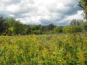
A project that began with a "For Sale" sign at an abandoned ski area along Petersburgh Pass in ten years became a multi‐state effort to preserve the Taconic Ridge between New York, and Massachusetts and Vermont. Some 10,000 acres and a major section of the long‐distance Taconic Crest (foot) Trail has been preserved through conservation easements or purchase by state agencies.
Both New York and Massachusetts in 1993 recognized the Taconics, a nearly unbroken wilderness, as a significant biological, scenic and timber resource. The environmental agencies of each state, working with local conservation non‐profits, have worked in partnership to identify critical parcels for protection and funding sources for the initiative. Groups such as the Taconic Hiking Club, the Trust for Public Land, the National Park Service, Williams College, Rensselaer‐Taconic Land Conservancy and the Williamstown Rural Lands Foundation joined by the state agencies, formed a citizens council to address issues of management and use (such as trail marking, maintenance and mapping) as more of the land comes under ownership of fewer entities. The Rensselaer Land Trust has provided support and assisted with trail work in this effort.
This project is a prime example of how public and private partnerships can work to promote landscape scale protection across political boundaries. Preservation of the resources provided by the Taconics continues to be a primary goal of all agencies involved. This cooperative effort is being facilitated by the Williamstown Rural Lands Foundation, a land trust that has been protecting the rural New England character of Williamstown since 1986.
The 37 mile Taconic Crest Trail brings you to breathtaking views and through 3 states with a wilderness experience only 45 minutes from Albany. Enjoy it in all four seasons. See http://taconichikingclub.org/ for information on the hiking map for this trail.
The Rensselaer Plateau Alliance is working with the Rensselaer Land Trust and other local organizations to develop the Rensselaer Plateau Regional Trails Vision, bringing all plateau municipalities, landowners, recreation organizations, and the public together to create a vision for a future network of trails. The first phase of the project developed a map of all existing public trails across the Rensselaer Plateau, and engaged the public in a series of workshops for both input and education. A final report summarized the results of the public process, and developed a draft vision map. (Web link)
Phase II, which is contingent upon funding, will allow for the development of a Trail Vision Plan. This Plan would illustrate the envisioned future trail network (including alternatives as appropriate). The plan will utilize graphics and photos to help convey the potential of this network as a recreational and economic asset to the Plateau and the region. This document will be distributed widely to inspire action by communities and organizations across the Plateau.
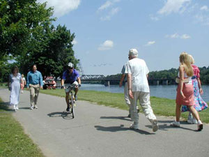
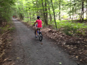
The Rensselaer Land Trust is an active partner in many trail projects with partners, and on our own preserves. Trails and greenways provide recreational opportunities and environmental benefits, including public health, economic and transportation benefits, and positive effects on community pride and identity.
Rensselaer Land Trust Preserves
The Rensselaer Land Trust has developed an extensive trail system on many of its preserves. To check out these trails, visit our preserves page that has more information and trails maps.
There is a consistent policy on the use of power driven mobility devices and accessibility under the Americans with Disability Act (ADA) on RLT owned and managed trails.
Albany Electric Trail
This proposed 15‐mile recreational trail would begin where Route 203 enters Rensselaer County and would extend north through the Town and Village of Nassau, where it would begin to head west through the Town of Schodack, eventually ending in the Town of East Greenbush near the City of Rensselaer line, in close proximity to Routes 9 and 20. A feasibility study was completed in 2011.
The Albany‐Hudson electric trail will result in the connection of the city of Albany with the city of Hudson. In so doing, trails on the west side of the Hudson River and along the Mohawk River allow for the connection with the very popular Harlem Valley Rail Trail and other trails on the east side of the Hudson.
The Village of Nassau is seeking funding for the first segment through various sources.
 A Facebook page has been established, where you can get the most up‐to‐date news on trail development (https://www.facebook.com/Albany-Hudson-Electric-Trail-641560142547523/?fref=ts)
Rensselaer Plateau Trail Vision
The Rensselaer Plateau Alliance (RPA) has taken the lead in developing a trail network on the Plateau that connects county‐wide. The Rensselaer Plateau Alliance worked with the Rensselaer Land Trust and other local organizations to develop the Rensselaer Plateau Regional Trails Vision, bringing all plateau municipalities, landowners, recreation organizations, and the public together to create a vision for a future network of trails. The first phase of the project developed a map of all existing public trails across the Rensselaer Plateau, and engaged the public in a series of workshops for both input and education. A final report summarized the results of the public process, and developed a draft vision map.

Phase II, which is contingent upon funding, will allow for the development of a Trail Vision Plan. This Plan would illustrate the envisioned future trail network (including alternatives as appropriate). The plan will utilize graphics and photos to help convey the potential of this network as a recreational and economic asset to the Plateau and the region. This document will be distributed widely to inspire action by communities and organizations across the Plateau. For more information, visit http://www.rensselaerplateau.org/trailvision.
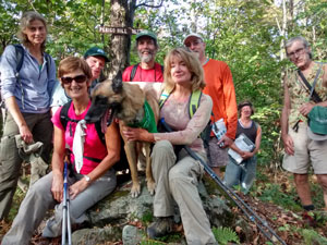
In preparation for a more formal Traverse trail, the Rensselaer Land Trust and RPA do a Traverse Hike every year in September. See the Outings page for details.
We were the lead organization in forming a Rensselaer County Trail Vision Plan in 2009. Since that time many trails have advanced. A Trail Vision Plan was published in 2015 and can be found here.
Taconic Crest Project
A project that began with a "For Sale" sign at an abandoned ski area along the Petersburg Pass, in ten years became a multi-state effort to preserve the Taconic Ridge between New York, Massachusetts, and Vermont. Some 10,000 acres and a major section of the long-distance Taconic Crest (foot) Trail have been preserved through conservation easements or purchase by state agencies.
Both New York and Massachusetts in 1993 recognized the Taconics, a nearly unbroken wilderness, as a significant biological, scenic, and timber resource. The environmental agencies of each state, in partnership with local conservation non-profits, worked to identify critical parcels for protection and funding sources for the initiative. Groups such as the Taconic Hiking Club, the Trust for Public Land, the National Park Service, Williams College, the Rensselaer-Taconic Land Conservancy (now the Rensselaer Land Trust) and the Williamstown Rural Lands Foundation formed a citizens council and joined with the state agencies to address issues of management and use, such as trail marking, maintenance, and mapping.
 This project is a prime example of how public and private partnerships can work to promote landscape scale protection across political boundaries. Preservation of the resources provided by the Taconics continues to be a primary goal of all agencies involved. The Rensselaer Land Trust continues to provide support for this effort and to assist with trail work.
The 37-mile Taconic Crest Trail brings you to breathtaking views and through three states. You can enjoy this wilderness experience, only 45 minutes from Albany, in all four seasons. See http://taconichikingclub.org/ for information on the hiking map for this trail.
Troy Urban Trails
The City of Troy is the lead agency on developing a trail network in the city
River Front Bikeway
The proposed South Troy Riverfront Bikeway/Walkway is a major component of the Working Waterfront, which will significantly enhance and improve the neighborhood’s quality of life and the economic health of South Troy. The bikeway/walkway will be designed to provide a recreational atmosphere in the South Troy Development District, while coexisting with adjacent uses such as business parks, research and industrial facilities, and the proposed Industrial Park Road. The bikeway/walkway will be connected to the TroyMenands bikeway/walkway, also in the preliminary design stage.
For more information:
 Uncle Sam Bikeway
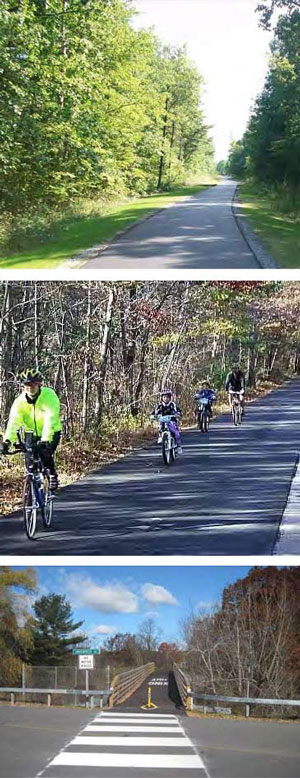
The Uncle Sam Bikeway is a three mile paved path with wildflowers, waterfalls and shale cliffs providing scenery alongside the route. The bikeway provides excellent walking for handicapped persons and for pushing wheelchairs and strollers. The bikeway is built on an old railroad roadbed and is entirely level with gentle curves as it follows the contours of the adjacent hill. The roadbed was constructed in 185052 by the Troy and Boston Railroad, which was leased to the Fitchburg Railroad in 1887, and then to the Boston and Maine Railroad in 1900. The tracks were dismantled in 197273 and the bikeway was opened in 1981.
Trail Facts
- Trail End Points: Troy to Lansingburgh
- Counties: Rensselaer
- Trail Length: 3.5 miles
- Trail Surfaces: Asphalt
- Trail Activities: Walk, Bicycle, Inline Skates
- Trail Closing: The bikeway is closed from dusk to dawn
For more information see:
- http://www.traillink.com/trail/uncle‐sam‐bikeway.aspx
- http://www.troyny.gov/Departments/Parks_Recreation/Bikeways.aspx
Urban Trails – Wynantskill Corridor
The newest trail is proposed to connect the River Front Bikeway via Burden Pond to Prospect Park, with a spur up the Wynantskill Creek to connect to RLT’s Staalesen Preserve. This trail was recently awarded planning funding from the Regional Economic Council/NYS Parks and Recreation. The Rensselaer Land Trust is an active partner with the City of Troy and the Post Contemporary Art Center in developing the trail. A preliminary map of the project can be seen here (INSERT LINK). Check back for updates as the project progresses!
Hudson Greenway
In 1991, the Hudson River Valley Greenway was created in part to establish a network of multiuse trails along both sides of the Hudson River. Today the Greenway is working to create a system of trails from the northern borders Saratoga and Washington counties to Manhattan. The Hudson River Greenway Trail System consists of two main components: a land trail and a water trail for paddling and boating. A major route included in the land trail is Bike Route 9, a northsouth onroad bicycling trail.
The Greenway Trail System web pages will help you to learn about efforts to develop the trail system, view maps of the trails, download a list of designated trails and sites, peruse information for users and owners of the trail, and explore information on upcoming trail events for the whole family. For information on the walking and bicycling trails please visit their Land Trail pages. For information on the Water Trail please visit their Water Trail pages.
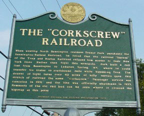
Corkscrew Rail Trail
The rail trail follows a section of the old Rutland Railroad which ran from Bennington, Vermont to Chatham, New York. Due to tight turns between hills, this section was called "The Corkscrew." Although abandoned in 1952, many sections of the rail beds are in good condition. The Corkscrew Rail Trail Association was formed in 2014 by trail advocates from Stephentown and New Lebanon. Crossing county lines, this group is working to get trail segments where the landowners are supportive open for year‐round recreational use, starting small and building links and support. The first segment opened on June 6, 2015. It is over three miles long, and goes south from Knapp Road, Stephentown past the Columbia County Line. The Corkscrew Rail Trail Association plans to work with other property owners to open additional sections in both New Lebanon and Stephentown.
 |
 |
The Rensselaer Land Trust and the Rensselaer Plateau Alliance have partnered with and fostered this project. For more information, trail map, photos, and more please see.
- http://www.corkscrewrailtrail.org
- https://www.facebook.com/Corkscrew-Rail-Trail-1606988559540861/?fref=ts
Rensselaer Land Trust Trail Vision Plan
We were the lead organization in forming a Rensselaer County Trail Vision Plan in 2009 (insert link to download pdf). That vision is becoming a reality thanks to the work of many enthusiastic volunteers. Explore our Partner Trails and enjoy the growing network of trails in Rensselaer County. For information on how you can join in trailblazing and maintenance, contact the Land Trust at renstrust@renstrust.org or (518) 659-5263.

 The Rensselaer Land Trust works with a variety of organizations to further our land conservation and watershed protection mission. Please visit our partner websites to learn more.
Land Conservation
- The Land Trust Alliance
- Battenkill Conservancy
- Williamstown Rural Lands Foundation
- The Hudson Valley Network
- New York Natural Heritage Program
- American Farmland Trust
- Beacon Institute for Rivers and Estuaries
- Rensselaer Plateau Alliance
- Agricultural Stewardship Association
- Vermont Land Trust
- New York State GIS Clearinghouse
- Hudsonia
- New York State DEC lands and forests
- Stockport Watershed
- Regional Conservation Parternship (RCP)
Local History and Resources
- Lansingburgh Historical Society
- Rensselaer County Home Page
- Genealogy of Rensselaer County Families
- The Political Graveyard: Political History and Cemeteries of Rensselaer County
- Rensselaer County Historical Society
- Oakwood Cemetery
Outdoor Recreation Opportunities
- New York State's Canal System
- Appalachian Mountain Club
- Dyken Pond Environmental Center
- Adirondack Mountain Club
- New York State Parks
- Hudson River Valley Greenway
- Friends of Grafton Lake State Park
- Corkscrew Rail Trail Association
- Audubon Society of the Capital Region
Subcategories
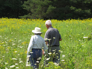
Rensselaer Land Trust owns and operates five public nature preserves with trails open to the public for passive recreation, such as wildlife observation or hiking. Additionally four of our five public nature preserves offer fishing and one has a boat launch. We welcome you to bring your leashed dogs and go for a walk in the woods, snowshoe and cross country ski, bird watch, or bring your fishing poles for a quiet day on the water. All of our preserves are open from dawn to dusk. Please click on our Preserve links below to find out more about our preserves, including directions, maps and general information. Several of our preserves are not open to the public daily because access to the preserve is over private land and trails do not exist. If you are interested in visiting one of these, please contact the office RLT@rensselaerplateaualliance or 518-712-9211 and an escort can be arranged for you.
Note, the following preserves are not open to the public full time; they are only open by arrangement: Bear's Den Preserve, Mud Lake Preserve (Shuba Preserve), and Pineswamp Preserve.
 Rensselaer Land Trust holds a conservation easement on 15 private lands. Land under a conservation easement is owned by a private landowner. A conservation easement does not mean that the property is open to the public. Rensselaer Land Trust holds some of the property rights, including the right to restrict development of the land. Most landowners elect to retain control over access to the land. Of our 15 conservation easement lands, four allow for public access. Please click on the Conservation Easement lands links below to find out more about our conservation easement properties.
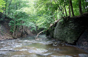
 With the assistance of area naturalists Steve Young and Russell Dunn, the Rensselaer Land Trust identified 56 waterfalls in Rensselaer County. To find out more about the waterfalls, including locations and descriptions, see Russell Dunn’s Adirondack Waterfall Guide: New York's Cool Cascades.The five waterfalls featured here were those which were visited on the 2000 RensselaerTaconic Land Conservancy (RTLC) waterfalls outing.
Explore natural areas and the rich history of Rensselaer County through these publications, which were a labor of love by our directors over the past 25 years. Some of the areas described in the portfolios are open to the public. This provides a rich opportunity to read about the history of these areas in depth and then visit the sites for a look at local history today.
Rensselaer Land Trust
PO Box 790
Averill Park, NY 12018
RLT@rensselaerplateau.org
(518) 712-9211
Show your support for the Rensselaer Land Trust through your annual membership or a donation.
Website design by Lighthouse Consulting & Design
 |
The Rensselaer Land Trust is a member of the Land Trust Alliance.