 Description
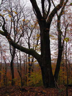
The Geiser Preserve is a beautiful woodland of 95 acres, high on the Rensselaer Plateau. The access route follows a level dirt road (Lindeman Road) through attractive woods. The Preserve has a one mile round trip trail to Perigo Hill (elevation 1873 feet) with partial winter views of the Catskills and Taconics. Look for Greylock to the east with a tower on top.
The forest consists of sugar maple, American beech, and eastern hemlock. The understory is full of witch hobble, striped maple, and an incredible carpet of ferns. There are two vernal pools where frog eggs can be found in the spring. There are a number of seasonal flowers. Jack-in-the-pulpit and many violets are found in the spring, and asters, white snakeroot, and goldenrods in the late summer and fall. Ferns include royal, interrupted, lady, wood, marginal shield, Christmas, maidenhair, hayscented, bracken, and grape.
It is a nice snowshoe or cross country ski in winter to reach the Preserve along Lindeman Road to the old Eastern Turnpike of 1802, which bisects the Preserve. The trail to Perigo Hill is steep and better for snowshoeing than skiing during winter. A great hike the rest of the year.
The Preserve was a gift of Ruth Nevin, a former Taborton teacher, who purchased the land in 1932. She remembers school picnics there when the land was open and the views superb. The name "Geiser" was chosen in memory of her parents. In the past, gathering of ferns and clubmosses for holiday greens was a substantial cottage industry in this part of the County (although it is prohibited now). On the south side of the Turnpike running through the Preserve is an old foundation and well, one of many homesites along the Turnpike which in the early 1800’s was the main road from Bath (Greenbush) to Deerfield, MA. Wood was cut on Perigo and transported by bobsled over the Turnpike to Sand Lake to use in the furnaces for glass making.
Rules
- The preserve is open to the public daily from dawn to dusk.
- Permitted activities: hiking, nature viewing, skiing, snowshoeing, educational study, and birding.
- Prohibited activities: hunting, trapping, collecting plants, camping except with permission from the Land Trust, fires , dumping, and all motorized vehicles.
- This is a carry-in/carry-out nature preserve.
Directions
From I90 Exit 8 and NY Route 43, take Route 43 east 8.6 miles to Taborton Rd., continue straight on Taborton Rd. 4 miles. Parking is available at Taborton Zion Church of Christ lot on right, unless there is an event at church. From the church lot, it is a 0.6 mile walk up Taborton Rd. to Lindeman Rd. on the left. Take Lindeman Rd. for 1.6 miles, go left on old Eastern Turnpike 0.3 miles to the preserve. Please respect private property on either side of road and stay on access road until preserve.