As of January 1, 2024, the Rensselaer Land Trust has merged with the Rensselaer Plateau Alliance. For all questions regarding donations, events, land, or other matters, please visit www.rensselaerplateau.org or call 518-712-9211. For questions about the merger, use extension 101 to speak with Jim Bonesteel. You can expect a new name and logo for our merged organization by Spring / Summer 2024 and a new website by the end of the year!
Get Involved

Get Outdoors

Get Informed

Conservation Easement Lands
 Rensselaer Land Trust holds a conservation easement on 15 private lands. Land under a conservation easement is owned by a private landowner. A conservation easement does not mean that the property is open to the public. Rensselaer Land Trust holds some of the property rights, including the right to restrict development of the land. Most landowners elect to retain control over access to the land. Of our 15 conservation easement lands, four allow for public access. Please click on the Conservation Easement lands links below to find out more about our conservation easement properties.
Town: Poestenkill
Number of acres: 62 acres
Protected since 2015
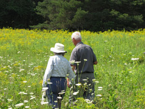
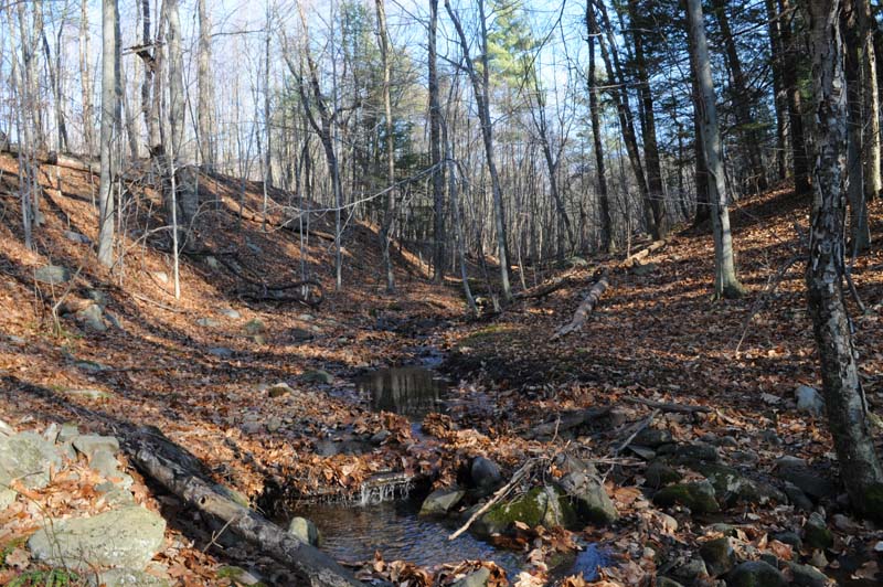
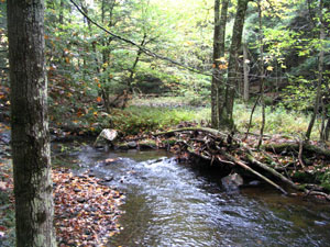
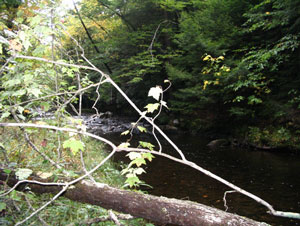
The donated 62 acre Colehamer Conservation Easement property is privately owned and is not open to the public. The property abuts another conservation easement property (Sluyter Conservation Easement), creating a 167acre regional conserved area. The property contains a wetland zone and a working forest zone. Each zone permits and restricts different activities. The property is a heavily wooded hillside with springs and intermittent streams flowing down to the Newfoundland Creek, a Class C(T) trout stream and a tributary of the Poesten Kill. There are a carriage trail and several walking trails on the property.
The property is located in a nationally designated Forest Legacy area. Its conservation values include
- an extensive forest with many kinds of trees of different age classes and canopy levels. This structural variety in the forest provides habitats for many animals, plants and fungi. The forest also serves as a wildlife corridor.
- a stream that flows into Newfoundland Creek, a Class C(T) trout stream that is part of the Poesten Kill watershed. Protecting the stream and its surrounding woods helps protect the water quality of Newfoundland Creek.
The public benefits of this conservation easement include protecting the scenic beauty and natural resources of the property and surrounding woodlands. Additionally the easement helps protect the water quality and quantity of the Newfoundland Creek, the Poesten Kill, and the Hudson River watersheds, sources of fresh water for numerous towns and cities, including New York City.
Photos
 Town located in: Brunswick
Number of acres: 8.2 acres
Protected since 2005
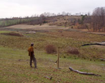
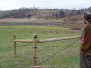 The Capital District Farms Conservation Easement property is privately owned and not open to the public. It is an 8.2 acre restored cattail wetland adjacent to a dairy farm. The owner worked with the USDA Natural Resources Conservation Service to prevent runoff from his operations and to keep cattle out of the wetland. The wetland is upstream from the Poestenkill aquifer and serves as a buffer between the dairy farm and the aquifer. This is a wetland mitigation site required of Besicorp‐Empire Power Company, LLC, who filled in a different wetland of 2.7 acres to construct a 16” natural gas pipeline. Rensselaer Land Trust worked together with the landowner of Capital District Farms, USDA Natural Resources Conservation Service, US Army Corps of Engineers, New York District and Besicorp‐Empire Power Company, LLC, to restore and protect this wetland. This conservation easement prohibits development, mining, dumping, draining, dredging, non‐forest agricultural uses, commercial activity, and motorized vehicles. The easement is a donated easement.
 Town located in: Stephentown
Number of acres: 12 acres
Protected since 1992
The Black River Conservation Easement property is privately owned by two different families and is open to the public by prearranged special permission from the landowners and Rensselaer Land Trust only for scientific and educational conservation purposes, fishing, hiking, and swimming. It is a donated 12 acre forever wild conservation easement in Stephentown. The property borders the Black River and is primarily covered by hemlock/northern hardwood forest on steep slopes. The ruins of a sawmill foundation and sluiceway can be seen. This easement prohibits development, mining, dumping, pipelines, and motorized vehicles.
Rensselaer Land Trust
PO Box 790
Averill Park, NY 12018
RLT@rensselaerplateau.org
(518) 712-9211
Show your support for the Rensselaer Land Trust through your annual membership or a donation.
Website design by Lighthouse Consulting & Design
 |
The Rensselaer Land Trust is a member of the Land Trust Alliance.