As of January 1, 2024, the Rensselaer Land Trust has merged with the Rensselaer Plateau Alliance. For all questions regarding donations, events, land, or other matters, please visit www.rensselaerplateau.org or call 518-712-9211. For questions about the merger, use extension 101 to speak with Jim Bonesteel. You can expect a new name and logo for our merged organization by Spring / Summer 2024 and a new website by the end of the year!
Get Involved

Get Outdoors

Get Informed

Conservation Easement Lands
 Rensselaer Land Trust holds a conservation easement on 15 private lands. Land under a conservation easement is owned by a private landowner. A conservation easement does not mean that the property is open to the public. Rensselaer Land Trust holds some of the property rights, including the right to restrict development of the land. Most landowners elect to retain control over access to the land. Of our 15 conservation easement lands, four allow for public access. Please click on the Conservation Easement lands links below to find out more about our conservation easement properties.
Town: Postenkill
Number of acres: 104.57 acres
Protected since 2014
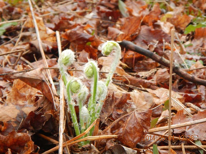
The donated 104.57 acre Sluyter Conservation Easement property is privately owned and is not open to the public. The property abuts another conservation easement property (Colehamer Conservation Easement), creating a 167 acre regional conserved area. The property contains a wet zone, agricultural zone, and a working forest zone. Each zone permits and restricts different activities. The property is a mix of grazing agricultural land, woods and wetlands. There are carriage and walking trails throughout the property.
The property is located in a nationally designated Forest Legacy area. Its conservation values include
- an extensive forest with many kinds of trees of different age classes and canopy levels. This structural variety in the forest provides habitats for many animals, plants and fungi. The forest also serves as a wildlife corridor.
- a stream that flows into Newfoundland Creek, a Class C(T) trout stream that is part of the Poesten Kill watershed. Protecting the stream and its surrounding woods helps protect the water quality of Newfoundland Creek.
The public benefits of this conservation easement include protecting the agricultural value, scenic beauty and natural resources of the property and surrounding woodlands. Additionally the easement helps protect the water quality and quantity of the Newfoundland Creek, the Poesten Kill, and the Hudson River watersheds, sources of fresh water for numerous towns and cities, including New York City.
Photos
Town located in: Schodack
Number of acres: 29.9 acres
Protected since 2005
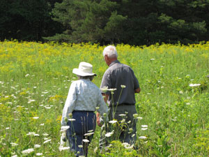
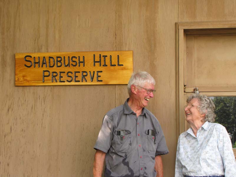
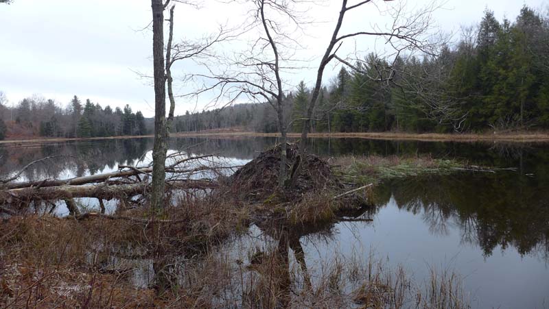
The donated 29.9 acre Shadbush Hill Conservation Easement is privately owned and not open to the public. The property contains old orchard trees, meadows, 18 birdhouses, woodlands, a pond, a wetland and the Balekill Stream, and is part of the watershed for the Muitzeskill Creek, which flows into the Hudson River. It is named after the beautiful blooming shadbush located on the property. The conservation easement is an agricultural and working forest easement permitting organic farming, berry picking and livestock farming with the exception of goats which are not allowed due to their destructive nature. It has 4 zones: forever wild, wetland, working forest and agriculture.
Photos
Town located in: Stephentown
Number of acres: 127.13 acres
Protected since 2013
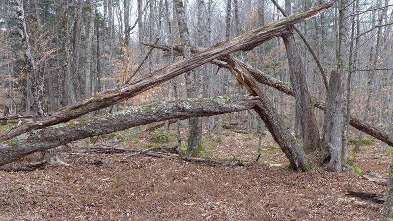
The donated 127.13 acre Ridgeline Conservation Easement property is privately owned and is open to the public only by prearranged special permission from the landowners and Rensselaer Land Trust and only for walking. The protected conservation values of the property are the water quality of Tributary 29 and its watershed, its agricultural and woodland viability and productivity, wetlands, wildlife diversity and habitats, landscape‐scale conservation and reduction of land fragmentation, and the conservation of its scenic and open space resources. It is a working forest conservation easement with five different zones where different activities are permitted and others restricted. The zones are a wetland/pond zone, wildflower zone, agricultural zone, barn area, and a working forest zone.
Photos
Town located in: Stephentown
Number of acres: 76.4 acres
Protected since 2007
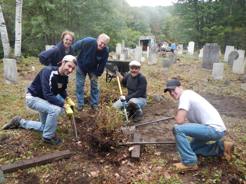
The donated 76.4 acre Randall Brook Conservation Easement property is privately owned and is not open to the public. The property contains an 18th century Baptist Cemetery that has been restored through the efforts of the original conservation easement donor, the Stephentown Historical Society and the Rensselaer Land Trust. The property has meadows, is heavily wooded with hardwoods and hemlocks, contains a beaver pond, several old woods roads and paths, and borders on the Randall Brook, a NYS designated Class C(T) trout stream. The easement is a working forest easement. Its primary purposes are to protect the Randall Brook Watershed, a NYS Department of Environmental Conservation Class II wetland, the Randall Brook, the forest’s productivity, and the scenic character of the property for the public. It has three zones: residential areas, working forest, and wetlands. This conservation easement allows for two building sites, each of which may have a single family residence and associated outbuildings built on them. The conservation easement prohibits further development, mining, and dumping.
Photos
Rensselaer Land Trust
PO Box 790
Averill Park, NY 12018
RLT@rensselaerplateau.org
(518) 712-9211
Show your support for the Rensselaer Land Trust through your annual membership or a donation.
Website design by Lighthouse Consulting & Design
 |
The Rensselaer Land Trust is a member of the Land Trust Alliance.